Roadway design in Durham, North Carolina, encompasses the comprehensive planning, engineering, and construction of pavement structures that form the backbone of the region’s transportation network. This category covers everything from subgrade evaluation to surface material selection, ensuring roads can withstand the Piedmont’s unique environmental demands. With Durham’s rapid population growth and its role as a hub in the Research Triangle, robust roadway infrastructure is critical for supporting commuter traffic, freight movement, and emergency services. A well-designed roadway not only enhances safety and ride quality but also reduces long-term maintenance costs for municipal and state agencies.
Durham sits atop the Triassic Basin, characterized by sedimentary rock formations and residual soils derived from weathered diabase and siltstone. These local geological conditions often yield expansive clay soils with moderate to high plasticity, which can swell when wet and shrink during dry periods, posing significant challenges for pavement stability. The region’s humid subtropical climate, with its freeze-thaw cycles and heavy seasonal rainfall, exacerbates subgrade variability. Without proper geotechnical evaluation, roads here are prone to rutting, cracking, and differential settlement, making site-specific analysis essential for any successful project.
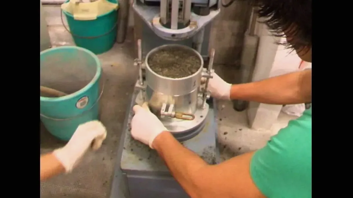
All roadway projects in Durham must adhere to standards set by the North Carolina Department of Transportation (NCDOT), which aligns with AASHTO guidelines and federal FHWA regulations. Key specifications include the NCDOT Standard Specifications for Roads and Structures, which dictate requirements for soil compaction, aggregate base courses, and asphalt or concrete mix designs. For geotechnical investigations, NCDOT mandates procedures such as the CBR study for road design to evaluate subgrade strength and determine pavement thickness. Compliance with these standards ensures that designs meet load-bearing capacity, drainage, and durability criteria specific to North Carolina’s environmental conditions.
Roadway design services are required across a wide spectrum of projects in Durham, from residential subdivision streets and commercial access roads to major arterial expansions and interstate highway rehabilitation. Urban infill projects often demand flexible pavement design for its adaptability to variable subgrades and ease of phased construction, while high-traffic corridors and industrial zones benefit from rigid pavement design for its longevity and resistance to deformation. Additionally, thorough geotechnical investigations, including laboratory testing of soil samples, are indispensable for projects like the Durham Belt Line Trail conversion or the widening of I-85, where historical soil data may be limited or outdated.
Roadway failures in Durham are typically driven by expansive clay subgrades that undergo volume changes due to moisture fluctuations, compounded by poor drainage and inadequate compaction. Freeze-thaw cycles during winter months can further weaken the pavement structure, leading to potholes, alligator cracking, and rutting, especially on roads with insufficient base course thickness or substandard materials.
Durham’s residual soils often exhibit low California Bearing Ratio (CBR) values, necessitating thicker pavement sections to distribute traffic loads effectively. Expansive clays require stabilization or removal to mitigate swelling pressures. A detailed geotechnical investigation quantifies these properties, allowing engineers to calibrate structural numbers in accordance with NCDOT design charts and AASHTO 1993 methodology for both flexible and rigid pavements.
Roadway construction in Durham typically requires an NCDOT encroachment permit for work within state right-of-way, along with local erosion control permits from Durham County’s Sedimentation and Erosion Control program. Projects impacting wetlands or streams may also need a Section 404 permit from the U.S. Army Corps of Engineers and a water quality certification from the North Carolina Division of Water Resources.
Sustainable roadway design in Durham incorporates recycled materials such as reclaimed asphalt pavement (RAP) and fly ash stabilization to reduce environmental impact. Permeable pavement sections are increasingly used in low-volume applications to manage stormwater runoff. Life-cycle cost analysis, as encouraged by FHWA, guides material selection to balance initial construction costs with long-term maintenance and environmental performance.
We serve projects across Durham and surrounding areas. More info.